Friday, 15 November 2013
Sunday, 10 November 2013
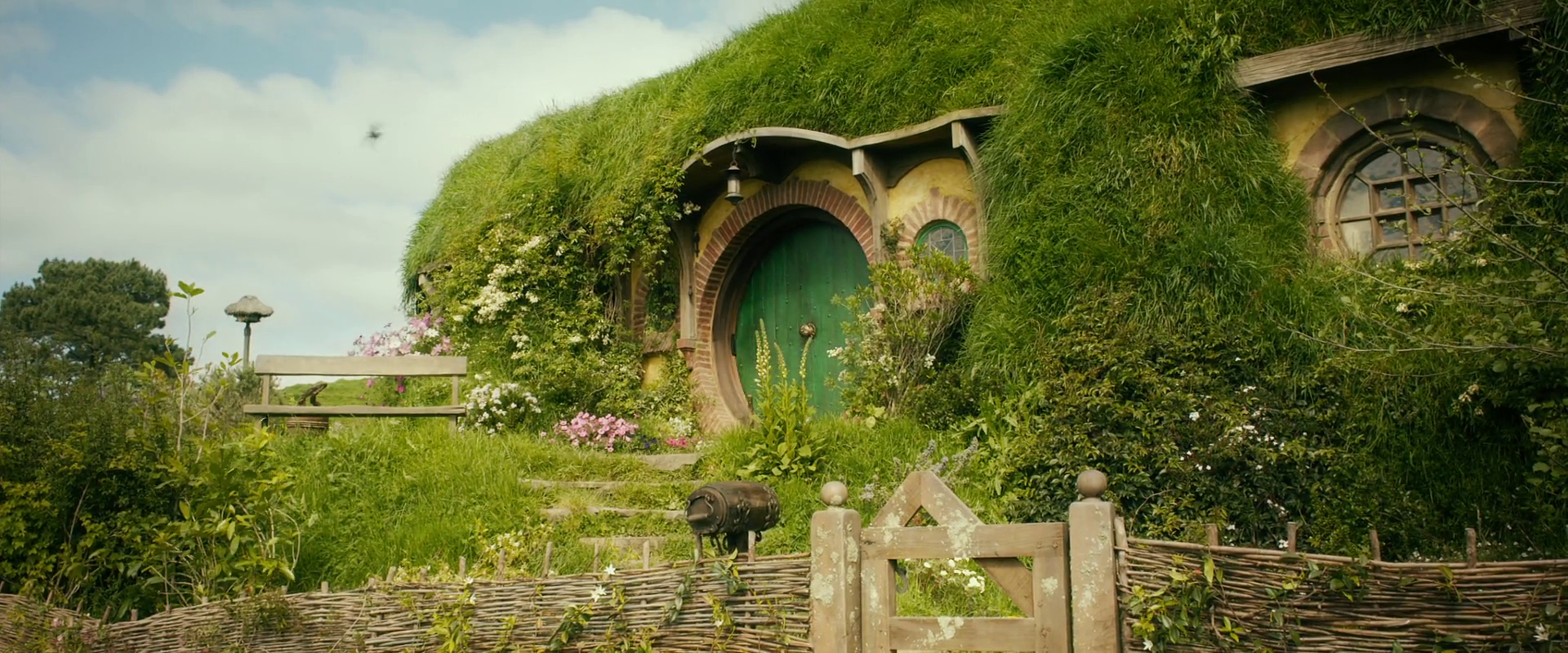
The Shire
The shire is situated to the far west of middle earth, past the misty mountains.
It is 18,000 square meters and is populated by Hobbits, a short, hardy people
who enjoy quiet lives filled with food and ale. The shire is bordered by
Westmarch to the west, the river Shirebourne to the south and Buckland to
the east. The area is very picturesque, with beautiful scenery and fruitful land.
It is covered with fields and small pockets of forests similarly to the English
country side on which it is based. It is a peaceful region in which there are
almost no battles. The Shire is split into four farthings:
Northfarthing
It is the smallest region of the Shire. It has the town of Hardbottle and the
bindbole woods which are the largest woods in the shire
Westfarthing
It is the home of the largest town in the shire, Michel Delving. It also has a
smaller town called little Delving which is north of Michel Delving. The majority
of the Tooks live there in the town of tuckborough. The town of Bywater is
home the shire biggest and most popular inn, the green dragon.
Southfarthing
An especially green area in the shire where the Longbottom is to be found,
the area in which all the Shires pipe weed is grown. It is also home to the
Overbourne, a marshy yet fertile area.
Eastfarthing
Mostly taken up by the Marish, a marshy region separated from the
Overbourne by the Brandywine River. It also has the city of Stock, which is the
second biggest city in the Shire.
Gondor
The region of Gondor lies in the west of middle earth opposite Mordor. It
stretches from the White Mountains to the north to the mountains of shadow
in the east. It used to be bigger but much of its lands were given to rohan.
The capital of Gondor is Minas Tirith which is the largest city of man in all of
middle earth. It stand opposite the city of Minis Morgual which was captured
by Sauron and is now the home of the ring wraith. The city is ruled by the King
but while the king is away there is a steward to take his place. It has been
estimated that the region of Gondor is about 716,000 square miles and it is
split up into different regions:
Ithilien
Ithilien lay between the river Anduin and the Mountains of Shadow to the far
east of Gondor. At the beginning of the third age it was a prosperous land but
as the threat of Mordor grew, it inhabitants left until it was only populated
by rangers who live in secret refuges. In the Lord of the Rings the Two Towers
Tolkien describes it as “a fair country of climbing woods and swift-falling
streams with gentle slopes shielded from the east by the Ephel Dúath and yet
not under the mountain-shadow, protected from the north by the Emyn Muil,
open to the southern airs and the moist winds from the Sea”. The area is home
to a vast array of plants, herbs and trees and during the fourth age is said to
have been the fairest country in the entire west.
Calenardhon
Calenardhon was situated to the north of the White Mountains. Its name
means the green province due to its wide plains and rolling hills. It was never
a heavily populated area but after the Great Plague most people migrated
south. The region was later attacked and would have been capture but for the
Éothéod cavalry who defeated the invaders and saved the region. As a reward
they were give Calenardhon and it was renamed Rohan.
Anfalas
Anfalas was to the south of the hills of Pinnath Gelin, between the rivers Lefnui
and Morthond. Its name means longbeach. Due to it being a long distance
from the capital and being constantly attacked by the Corsairs of Umbar, it was
never a very densely populated area.
Belfalas
A shore land between the city of Dul Amroth and the island of Tolfalas after
which the Bay of Belfalas was named. The element of falas in its name means
shore.
Subscribe to:
Posts (Atom)